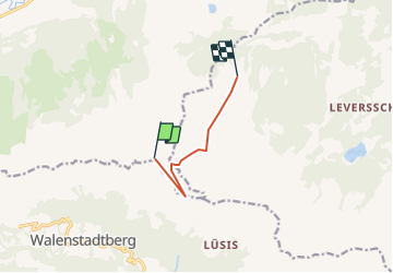
![](/images/other/stat-length.png)
![Tour Andere Aktivitäten Wildhaus-Alt St. Johann - Chäserrugg -Gamsalp - Photo](https://media.geolcdn.com/t/1900/400/ext.pjpeg?maxdim=2&url=https%3A%2F%2Fstatic1.geolcdn.com%2Fsiteimages%2Fupload%2Ffiles%2F1545311037marcheuse_200dpi.jpg)
Chäserrugg -Gamsalp
jschna
Benutzer
![Länge](/images/other/stat-length.png)
![Maximale Höhe](https://static1.geolcdn.com/siteimages/upload/files/1508320355ic_sort_altitude_max_24dp.png)
![Positive Höhendifferenz](https://static1.geolcdn.com/siteimages/upload/files/1508320355ic_sort_den_pos_24dp.png)
![Km-Effort](/images/other/stat-length.png)
![Min. Höhe](https://static1.geolcdn.com/siteimages/upload/files/1508320355ic_sort_altitude_min_24dp.png)
![Negative Höhendifferenz](https://static1.geolcdn.com/siteimages/upload/files/1508320355ic_sort_den_neg_24dp.png)
![Boucle](https://static1.geolcdn.com/siteimages/upload/files/16400158638029165_repeat_loop_refresh_sync_direction_icon.png)
![Andere Aktivitäten](https://static1.geolcdn.com/sitytour/trail-icons/900.png)
--
Schwierigkeit : Unbekannt
![Scannen Sie diesen QR-Code, um die Tour in der SityTrail-Anwendung zu öffnen](https://capi.geolives.com/qq0zvz2zws4bq2lad0pu/sitytour/trails/20230/qr.png?size=200)
Kostenlosegpshiking-Anwendung
Über SityTrail
Tour Andere Aktivitäten von 5 km verfügbar auf Sankt Gallen, Wahlkreis Toggenburg, Wildhaus-Alt St. Johann. Diese Tour wird von jschna vorgeschlagen.
Beschreibung
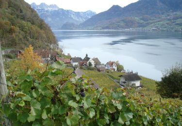
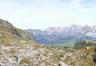
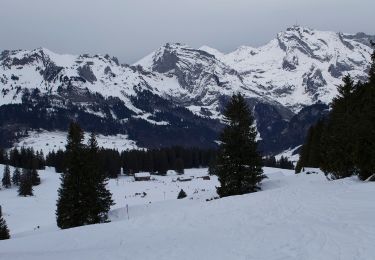
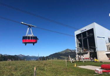
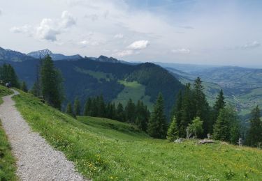
Mit der Bahn auf den Chäserrugg - wundeerbare Aussicht ins Sarganserland und auf den Säntis (Steinbockkolonie) - der erste Teil ist etwas steil und steinig, dann aber leicht und gut zum Gehen bis zur Gamsalp, wo der Wirt - Dres Forrer die Gäste verwöhnt.
Ort
Kommentare
Touren in der Umgebung
![Tour Zu Fuß Walenstadt - Walenstadt - Pluder - Photo](https://media.geolcdn.com/t/375/260/f2f44868-cecd-4f43-90e0-8033a6707992.jpeg&format=jpg&maxdim=2)
![Zu Fuß Zu Fuß](https://static1.geolcdn.com/sitytour/trail-icons/100.png)
Zu Fuß
![](/images/other/stat-length.png)
![](https://static1.geolcdn.com/siteimages/upload/files/16400158638029165_repeat_loop_refresh_sync_direction_icon.png)
![Tour Zu Fuß Walenstadt - Hochrugg - Tschingla - Photo](https://media.geolcdn.com/t/375/260/4e3e585d-dcea-4eee-82b3-d518025e1ba9.jpeg&format=jpg&maxdim=2)
![Zu Fuß Zu Fuß](https://static1.geolcdn.com/sitytour/trail-icons/100.png)
Zu Fuß
![](/images/other/stat-length.png)
![](https://static1.geolcdn.com/siteimages/upload/files/16400158638029165_repeat_loop_refresh_sync_direction_icon.png)
![Tour Zu Fuß Walenstadt - Hochrugg - Tschingla - Photo](https://media.geolcdn.com/t/375/260/53d53d06-e363-4149-ab8a-6920b0164781.jpeg&format=jpg&maxdim=2)
![Zu Fuß Zu Fuß](https://static1.geolcdn.com/sitytour/trail-icons/100.png)
Zu Fuß
![](/images/other/stat-length.png)
![](https://static1.geolcdn.com/siteimages/upload/files/16400158638029165_repeat_loop_refresh_sync_direction_icon.png)
![Tour Zu Fuß Walenstadt - Walenstadtberg - Quinten - Photo](https://media.geolcdn.com/t/375/260/a4a8e10a-f071-4fc8-879d-94c4af5a5995.jpeg&format=jpg&maxdim=2)
![Zu Fuß Zu Fuß](https://static1.geolcdn.com/sitytour/trail-icons/100.png)
Zu Fuß
![](/images/other/stat-length.png)
![](https://static1.geolcdn.com/siteimages/upload/files/16400158638029165_repeat_loop_refresh_sync_direction_icon.png)
![Tour Zu Fuß Grabs - Geologischer Rundweg Gamserrugg - Photo](https://media.geolcdn.com/t/375/260/22bf82fc-0ce7-45ad-b119-a1dbe35e1654.jpeg&format=jpg&maxdim=2)
![Zu Fuß Zu Fuß](https://static1.geolcdn.com/sitytour/trail-icons/100.png)
Zu Fuß
![](/images/other/stat-length.png)
![](https://static1.geolcdn.com/siteimages/upload/files/16400158638029165_repeat_loop_refresh_sync_direction_icon.png)
![Tour Zu Fuß Wildhaus-Alt St. Johann - Unterwasser-Halden-Egerten-Gräppelensee - Photo](https://media.geolcdn.com/t/375/260/35e5a00e-49e6-4b57-bd90-3eb5018a0ac1.jpeg&format=jpg&maxdim=2)
![Zu Fuß Zu Fuß](https://static1.geolcdn.com/sitytour/trail-icons/100.png)
Zu Fuß
![](/images/other/stat-length.png)
![](https://static1.geolcdn.com/siteimages/upload/files/16400158638029165_repeat_loop_refresh_sync_direction_icon.png)
![Tour Zu Fuß Wildhaus-Alt St. Johann - Sagenweg - Photo](https://media.geolcdn.com/t/375/260/039edbbf-db49-4f16-95e5-54c44d2e1a4f.jpeg&format=jpg&maxdim=2)
![Zu Fuß Zu Fuß](https://static1.geolcdn.com/sitytour/trail-icons/100.png)
Zu Fuß
![](/images/other/stat-length.png)
![](https://static1.geolcdn.com/siteimages/upload/files/16400158638029165_repeat_loop_refresh_sync_direction_icon.png)
![Tour Zu Fuß Wildhaus-Alt St. Johann - Klangweg - Photo](https://media.geolcdn.com/t/375/260/fc04d86b-e504-4363-83a7-958513154a67.jpeg&format=jpg&maxdim=2)
![Zu Fuß Zu Fuß](https://static1.geolcdn.com/sitytour/trail-icons/100.png)
Zu Fuß
![](/images/other/stat-length.png)
![](https://static1.geolcdn.com/siteimages/upload/files/16400158638029165_repeat_loop_refresh_sync_direction_icon.png)
![Tour Wandern Wildhaus-Alt St. Johann - . Oberdorf - Strichboden en passant Chäserrugg - Photo](https://media.geolcdn.com/t/375/260/6b56bd3a-2807-4370-a942-31e304753a78.jpg&format=jpg&maxdim=2)
![Wandern Wandern](https://static1.geolcdn.com/sitytour/trail-icons/101.png)
Wandern
![](/images/other/stat-length.png)
![](https://static1.geolcdn.com/siteimages/upload/files/16400158638029165_repeat_loop_refresh_sync_direction_icon.png)